HURRICANE BERYL
- Beryl strengthened back to a hurricane in the warm waters of the Gulf of Mexico Sunday night. It made landfall near Matagorda at around 4 a.m. Monday, but by 10 a.m., it had been downgraded to a tropical storm. By Monday evening, it had been downgraded to a tropical depression.
- Seven people in Texas have died in the storm, including a drowning, a house fire, and those who were hit by trees.
- Acting Gov. Dan Patrick said steady rains from Beryl moving through East Texas and NE Texas will flow downstream into Houston, leading to more flooding.
Texas officials say restoring electricity will take days after Beryl came ashore Monday as a Category 1 hurricane and knocked out power to nearly 3 million homes and businesses. The storm has since left Texas, but it is still threatening to flood areas of western Louisiana and Arkansas.
Texas Lt. Gov. Dan Patrick, who is acting governor while Gov. Greg Abbott is out of the country, said CenterPoint Energy was bringing in thousands of additional workers to help get the lights turned back on quicker. He said the storm toppled 10 transmission lines and that many of the outages were caused by fallen trees.
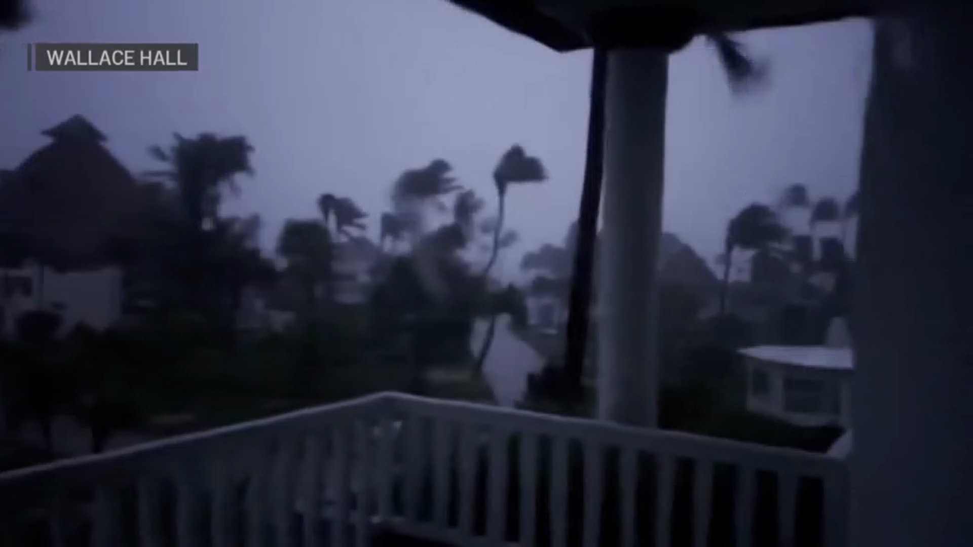
Beryl sped across the Texas coast on Monday, unleashing heavy rains that prompted dozens of high-water rescues. The fast-moving tempest threatened to carve a harsh path over several more states in the coming days. At least seven people were killed as Beryl moved through Texas, including a drowning, a house fire, and those who were hit by trees.
Get top local stories in DFW delivered to you every morning. >Sign up for NBC DFW's News Headlines newsletter.
Within hours after Beryl swept ashore as a Category 1 hurricane, it had weakened into a tropical storm, far less powerful than the Category 5 behemoth that tore a deadly path of destruction through parts of Mexico and the Caribbean last weekend. By Monday afternoon, Beryl was again downgraded to a tropical depression, meaning the storm's maximum wind speeds were 38 mph or less.
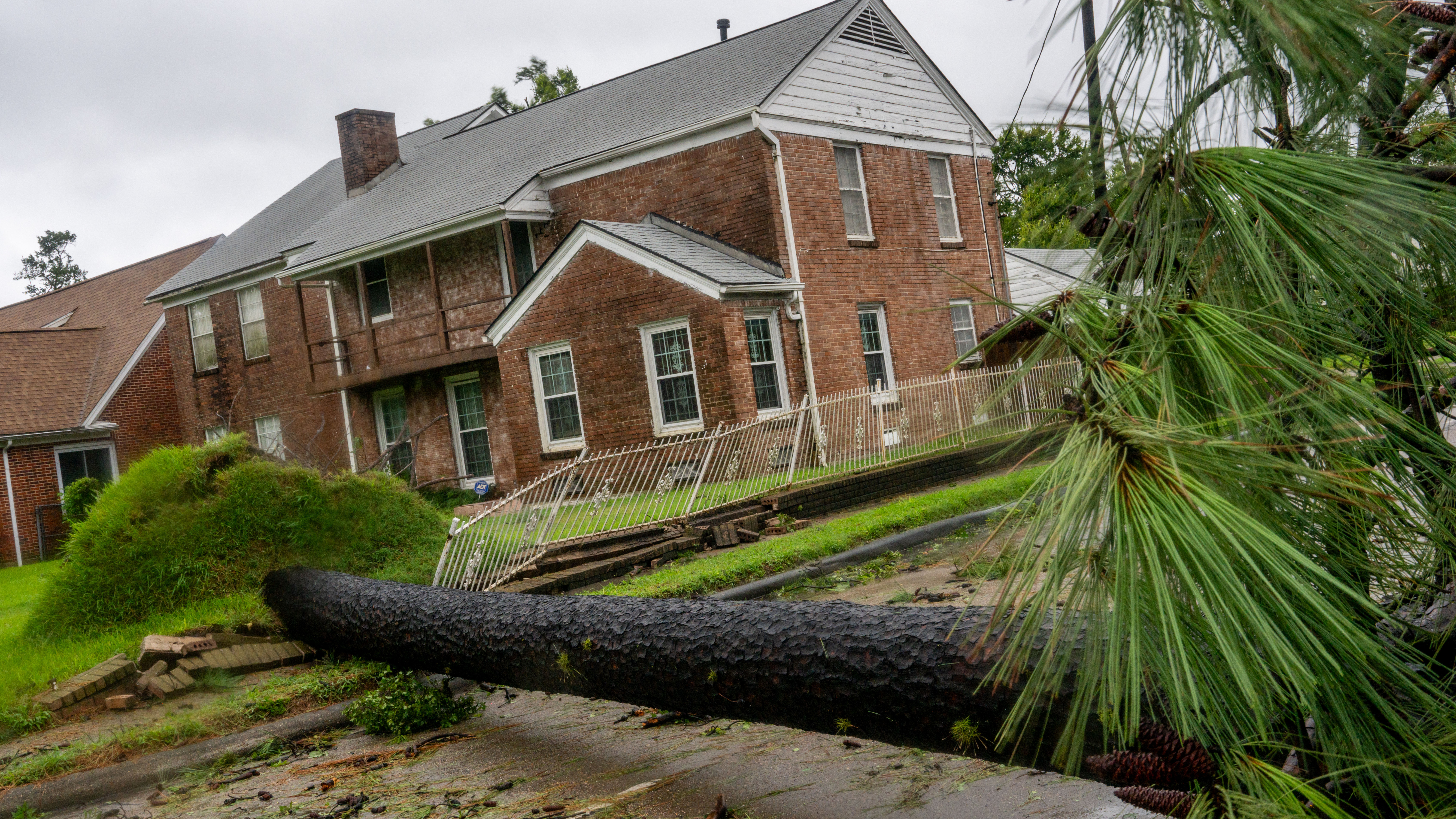
But the winds and rains of the fast-moving storm were still powerful enough to knock down hundreds of trees that had already been teetering in water-saturated earth and to strand dozens of cars on flooded roadways.
At least three people were killed when trees fell on homes, and the National Hurricane Center said damaging winds and flash flooding would continue as Beryl pushes inland. A fourth person, a civilian employee of the Houston Police Department, was killed when he was trapped in flood waters under a highway overpass, Houston Mayor John Whitmire said. There were no immediate reports of widespread structural damage, however.
Houston fire officials confirmed that a fifth person was killed during a house fire, and two additional deaths were discovered in a tent in a wooded area in Magnolia.
More than 2.7 million homes and businesses were without power around Houston, the nation's fourth-largest city, after Beryl blew through, according to the CenterPoint Energy utility. For many, it was an all-too-familiar experience: Powerful storms had just ripped through the area in May, killing eight people, leaving nearly 1 million without power and flooding numerous streets.
State officials also recommended people in areas where the storm has passed to stay indoors after dark due to the large number of downed power lines, some of which may still be energized.
Residents without power after Beryl were doing their best.
“We haven’t really slept,” said Eva Costancio as she gazed at a large tree that had fallen across electric lines in her neighborhood in the Houston suburb of Rosenberg. Costancio, 67, said she had already been without power for several hours and worried that food in her refrigerator would be spoiled.
“We are struggling to have food and losing that food would be difficult,” she said.
Houston and Harris County officials said power crews would be sent into the area to restore service as quickly as possible, an urgent priority for homes without air conditioning in the middle of summer. Temperatures, which had cooled slightly with the storm, were expected to reach back into the 90s as early as Tuesday.
“While these efforts are full steam ahead, we want residents to know and prepare for a possible multi-day power outage," Galveston city officials said on Facebook. "The estimated timeline is anywhere from 72 hours to two weeks in parts of the island.”
Beryl's rains pounded Houston and other coastal areas on Monday, reclosing streets in neighborhoods that had already washed out from previous storms. On Monday, television stations broadcast the dramatic rescue of a man who had climbed to the roof of his pickup truck after it got trapped in fast-flowing waters. Emergency crews used an extension ladder from a fire truck to drop him a life preserver and a rope before moving him to dry land.
Houston officials reported at least 25 water rescues by Monday afternoon, mostly for people with vehicles stuck in floodwaters.
“First responders are putting their lives at risk. That’s what they’re trained for. It’s working,” Houston Mayor John Whitmire said.
Javier Mejia was one of about 20 people who gathered near the pickup truck rescue site to take pictures of other submerged vehicles sitting on the flooded highway.
“If you don’t have a way through, you’re going to get stuck like that,” Mejia said.
Having experienced previous storms in Houston, Mejia stocked up on food and water before Beryl hit, but forgot gas for his portable generator. He planned to spend the day looking for some.
“I don’t want it to go bad," he said of the food, adding that if he can't find gas, “We can just fire up the grill.”
Many streets and neighborhoods throughout Houston were littered with fallen branches and other debris. The buzz of chainsaws filled the air Monday afternoon as residents set to work chopping up knocked-down trees and big branches that had blocked streets and sidewalks.
Three people were killed after trees fell on their houses: a man in the Houston suburb of Humble, a woman in Harris County, and a Montgomery County man who was struck by a falling tree while operating a tractor, authorities said. Hundreds of trees fell in the county, crushing vehicles and damaging homes, said Precinct 4 County Constable Mark Herman.
Patrick warned that flooding could last for days as rain continued falling on saturated ground and that Houston's flooding issues would only worsen as rains falling in East Texas and North East Texas flowed downstream toward Houston and the Gulf of Mexico.
“This is not a one-day event,” he said.

The White House said President Joe Biden received regular updates on the storm after it made landfall. When asked if he'd heard from the president, acting Gov. Patrick said he hadn't but that representatives with FEMA were working with the state on the response.
The U.S. Coast Guard and FEMA had prepared search and rescue teams, and FEMA collected bottled water, meals, tarps, and electric generators in case they were needed.
Several companies with refineries or industrial plants in the area reported that the power disruptions necessitated the flaring of gases at the facilities.
Marathon Petroleum Corp. said it conducted a “safe combustion of excess gases” at its Galveston Bay Refinery in Texas City. However, it did not provide information on how much gas flared or how long it would continue. According to the Texas Commission on Environmental Quality, Formosa Plastics Corporation and Freeport LNG also reported flaring related to Beryl.
A TCEQ representative emailed that companies have 24 hours to share emissions data after the flaring stops.
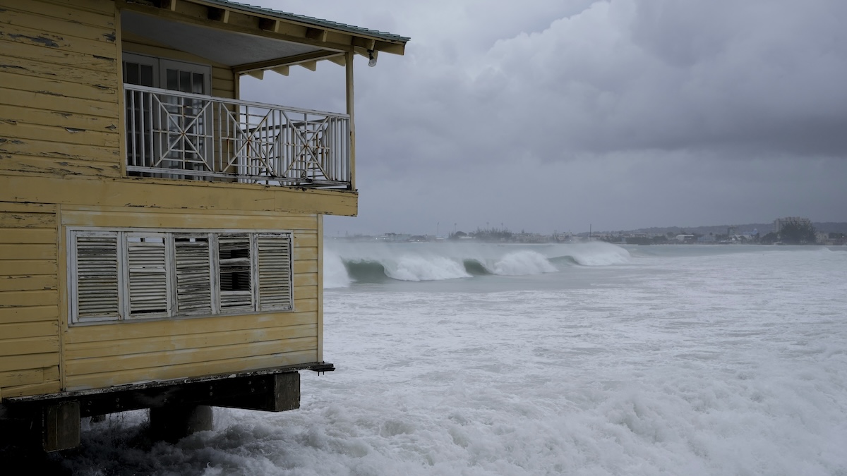
The earliest storm to develop into a Category 5 hurricane in the Atlantic, Beryl caused at least 11 deaths as it passed through the Caribbean on its way to Texas. The storm ripped off doors, windows and roofs with devastating winds and storm surge fueled by the Atlantic’s record warmth.
Three times during the week, Beryl gained 35 mph in wind speed in 24 hours or less, the official weather service definition of rapid intensification.
Experts said Beryl’s explosive growth into an unprecedented early whopper of a storm indicates the hot water of the Atlantic and Caribbean and what the Atlantic hurricane belt can expect for the rest of the storm season. Officials said in Jamaica that island residents will have to contend with food shortages after Beryl destroyed over $6.4 million in crops and supporting infrastructure.
In Louisiana, heavy bands of rain were expected all day Monday, and “the risk is going to be for that heavy rainfall and potential for flash flooding,” National Weather Service meteorologist Donald Jones said in a Facebook Live briefing on Monday morning.
Meteorologists in Louisiana are watching for lingering rainbands, which could drop copious amounts of rain wherever they materialize, as well as “quick, spin-up tornadoes,” said Donald Jones, a National Weather Service meteorologist in Lake Charles, Louisiana.
“It’s just a matter of exactly where that’s going to be,” Jones said. “That’s very difficult to predict more than maybe an hour or so in advance.”
Beryl was forecast to bring more strong rain and winds into additional states over the coming days. One of those, Missouri was already dealing with a wet summer. Heavy rains unrelated to the storm prompted water rescues around Columbia, where rivers and creeks were already high ahead of Beryl's expected arrival on Tuesday.

DISASTER DECLARATION FOR 121 TEXAS COUNTIES
Lt. Gov. Dan Patrick, who is acting governor while Gov. Greg Abbott is traveling in Taiwan, issued a preemptive disaster declaration for 121 counties.
As the storm neared the coast, Texas officials warned Sunday it could cause power outages and flooding but also expressed worry that not enough residents and beach vacationers in Beryl’s path had heeded warnings to leave.
“One of the things that kind of trigger our concern a little bit, we’ve looked at all of the roads leaving the coast and the maps are still green,” said Texas Lt. Gov. Dan Patrick, who is serving as the state’s acting governor while Gov. Greg Abbott is traveling overseas. “So we don’t see many people leaving.”
The White House said Sunday that the Federal Emergency Management Agency had sent emergency responders, search-and-rescue teams, bottled water and other resources along the coast.
EVACUATIONS BEGAN OVER THE WEEKEND ALONG THE TEXAS COAST
Some coastal cities called for voluntary evacuations in low-lying areas that are prone to flooding, banned beach camping and urged tourists traveling on the Fourth of July holiday weekend to move recreational vehicles from coastal parks.
Mitch Thames, a spokesman for Matagorda County, said officials issued a voluntary evacuation request for the coastal areas of the county about 100 miles southwest of Houston.
“Our No. 1 goal is the health and safety of all our visitors and of course our residents. I’m not so much worried about our residents. Those folks that live down there, they’re used to this, they get it,” Thames said.
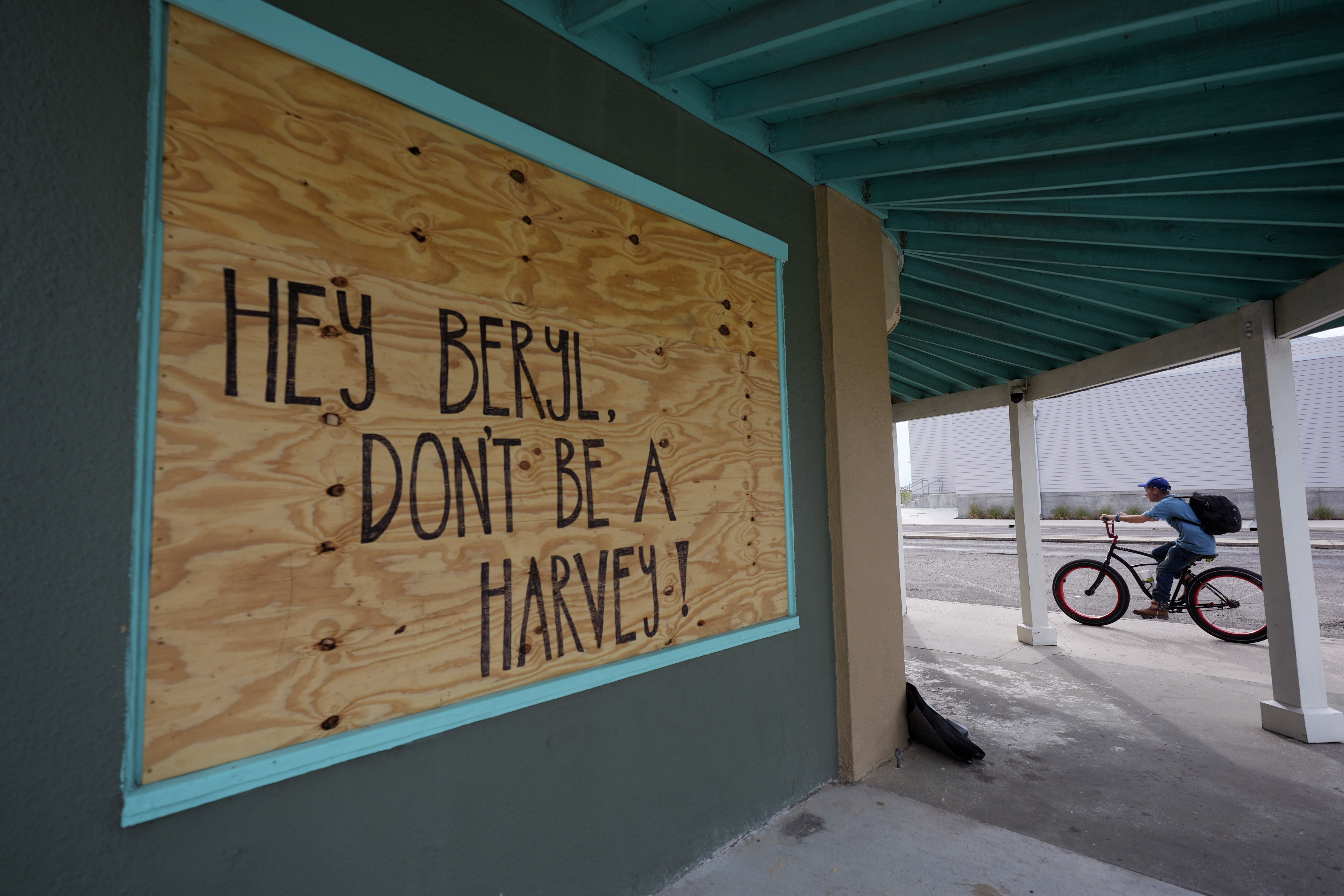
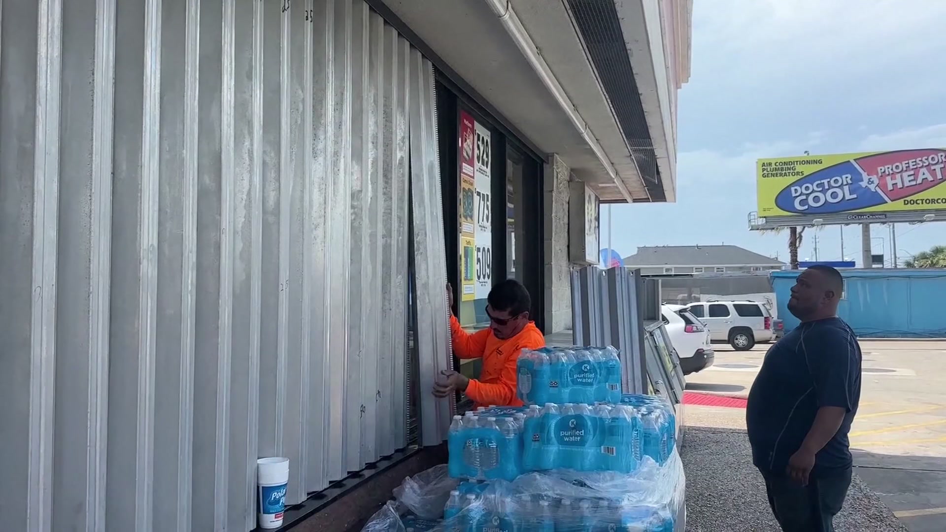
In Corpus Christi, officials asked visitors to cut their trips short and return home early if possible. Residents were advised to secure homes by boarding up windows if necessary and using sandbags to guard against possible flooding.
Employee Elizabeth Landry said Saturday that traffic has been nonstop for the past three days at an Ace Hardware in the city as customers buy tarps, rope, duct tape, sandbags, and generators.
“They’re just worried about the wind, the rain,” she said. “They’re wanting to prepare just in case.”
Ben Koutsoumbaris, general manager of Island Market on Corpus Christi’s Padre Island, said there has been “definitely a lot of buzz about the incoming storm,” with customers stocking up on food and drinks, particularly meat and beer.
In Refugio County, north of Corpus Christi, officials issued a mandatory evacuation order for its 6,700 residents.
Many residents and business owners took the typical storm precautions but also expressed uncertainty about the storm’s intensity.
In Port Lavaca, Jimmy May fastened plywood over the windows of his electrical supply company and said he wasn’t concerned about the possible storm surge. He recalled his business had escaped flooding in a previous hurricane that brought a 20-foot storm surge.
“In town, you know, if you’re in the low-lying areas, obviously, you need to get out of there,” he said.
At the nearby marina, Percy Roberts showed his neighbor Ken Waller how to properly secure his boat as heavy winds rolled in from the bay Sunday evening.
“This is actually going to be the first hurricane I’m going to be experiencing,” Waller said, noting he is a little nervous but feels safe following Roberts’ lead. “Pray for the best but expect the worst, I guess.”
AT LEAST 11 KILLED AS BERYL ROARED THROUGH THE CARIBBEAN
The earliest storm to develop into a Category 5 hurricane in the Atlantic, Beryl caused at least 11 deaths as it passed through the Caribbean on its way to Texas. The storm ripped off doors, windows and roofs with devastating winds and storm surge fueled by the Atlantic’s record warmth.
Three times during its one week of life, Beryl has gained 35 mph in wind speed in 24 hours or less, the official weather service definition of rapid intensification.
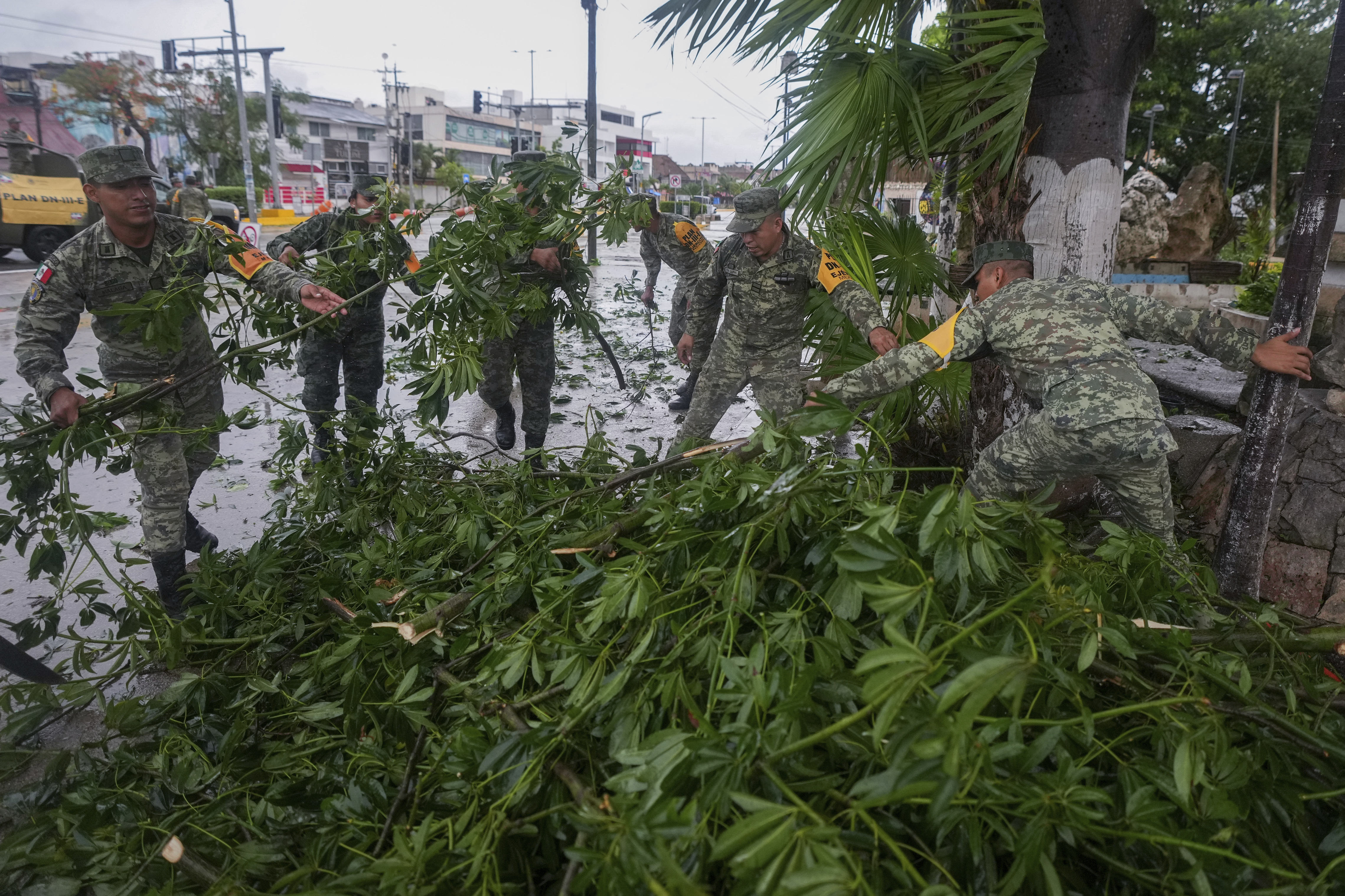
Beryl battered Mexico as a Category 2 hurricane, toppling trees but causing no injuries or deaths before weakening to a tropical storm as it moved across the Yucatan Peninsula.
Before hitting Mexico, Beryl wrought destruction in Jamaica, St. Vincent and the Grenadines, and Barbados. Three people were reported dead in Grenada, three in St. Vincent and the Grenadines, three in Venezuela and two in Jamaica.
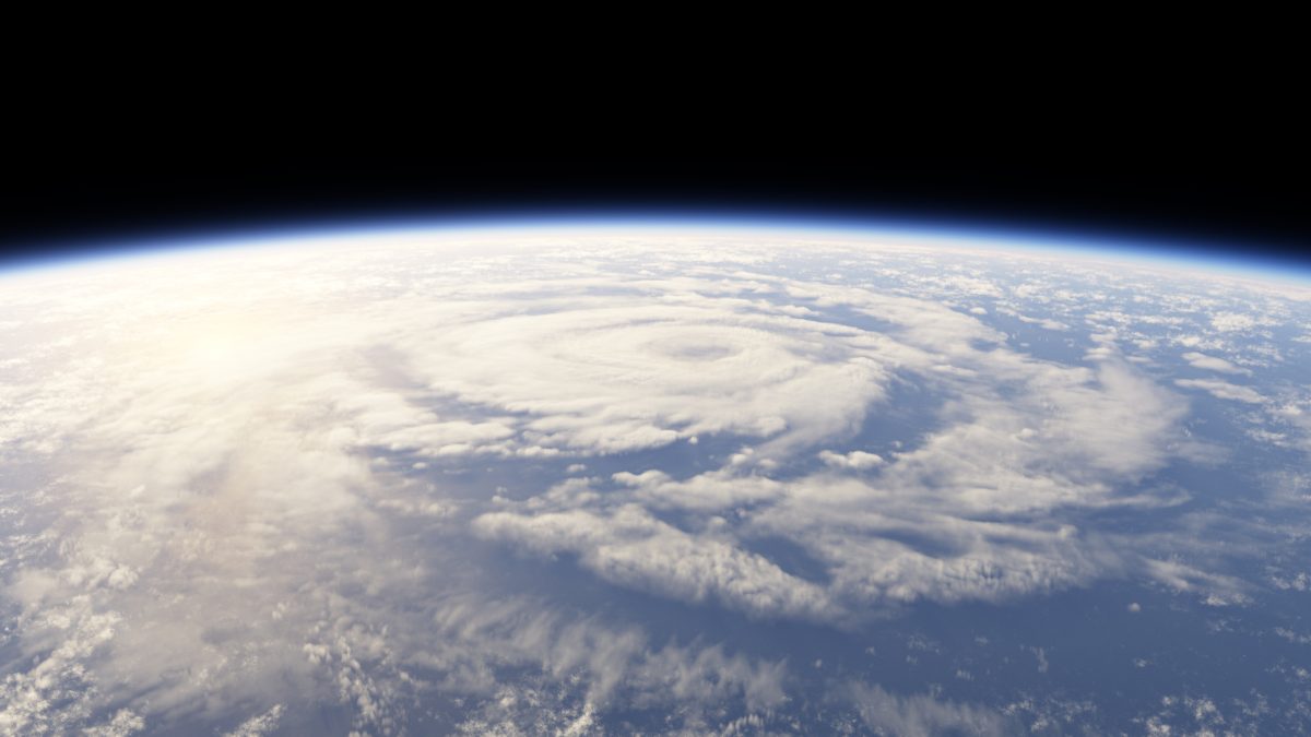
Beryl’s explosive growth into an unprecedented early whopper of a storm indicates the hot water of the Atlantic and Caribbean and what the Atlantic hurricane belt can expect for the rest of the storm season, experts said.
HURRICANE BERYL
WARM WATER MAKES HURRICANE FORMATION MORE FAVORABLE
Unusually warm water in this area has made storm formation more favorable. Water temperatures in the tropical Atlantic this year have been well above average.
Current water temperatures are more representative of temperatures found in late August. Warm water is one of the key ingredients for developing tropical systems.
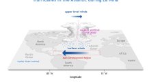
Warm ocean water is just one of the reasons why NOAA (The National Oceanic and Atmospheric Administration) predicts an active Atlantic hurricane season. Another major factor is La Nina. The El Nino pattern present for much of the last year has faded. In its place is a developing La Nina. In a La Nina pattern, the upper-level winds over the tropical Atlantic are weaker, leading to less wind shear and more favorable conditions for storms to develop.
Stay tuned to what will likely be an active tropical season.

