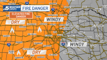
A powerful storm system brought severe thunderstorms and damage Tuesday morning. All of the Tornado Watches remain east of DFW expiring by this afternoon. The main concern now shifts the high winds expected this afternoon and the elevated fire danger.
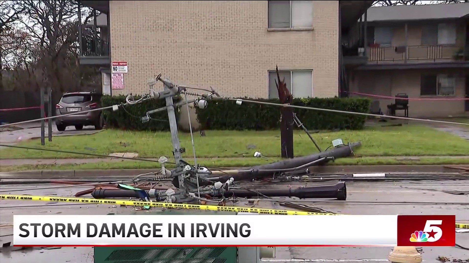
A potent storm system moved into North Texas early Tuesday morning, setting off outdoor warning sirens and leaving behind damage. A new wind advisory for North Texas has been issued.
Wind Advisory due to damaging winds
Watch NBC 5 free wherever you are
A new Wind Advisory is in effect for parts of North Texas, including Tarrant, Dallas, Denton and Collin Counties as well as counties north and east until 9 a.m. Wednesday. Expect winds from 20 to 35 mph with gusts up to 45 mph.
Please secure all outdoor equipment. Unsecured outdoor items may be blown around in the wind. Driving on area roadways may become difficult, especially for high-profile vehicles. Also, small tree limbs could break and cause damage.
Get top local stories in DFW delivered to you every morning with NBC DFW's News Headlines newsletter.

Storm season is just beginning. Make sure you have the NBC DFW app downloaded to stay ahead of the storms!
Fire danger remains elevated
The strong winds and dropping relative humidity will elevate the threat of fire danger to much of North Texas. A Fire Weather Watch has been issued for areas along/south of I-20 and along/west of Highway 281, in Erath, Comanche and Hamilton counties.
Drivers are encouraged to avoid activities that could cause sparks, such as dragging towing chains, parking on tall grass, tossing cigarette butts onto dry grass or out of moving vehicles. North Texans are also encouraged to forgo burning trash or leaves.