A strong fall cold front has arrived! Temperatures this morning are starting off quite chilly with widespread 40s and 50s. A brisk northeast breeze is making feel even cooler. Cool conditions will stick around all day under sunny skies. For a change, temperatures will be well below normal with afternoon highs holding in the mid to upper 60s (normal high is 79).
Thursday will start off even cooler with lows in the mid 40s. Parts of Northeast Texas may experience upper 30s! Temperatures will rebound nicely into the 70s. A gradual warming trend can be expected toward the weekend with highs returning to around 80.
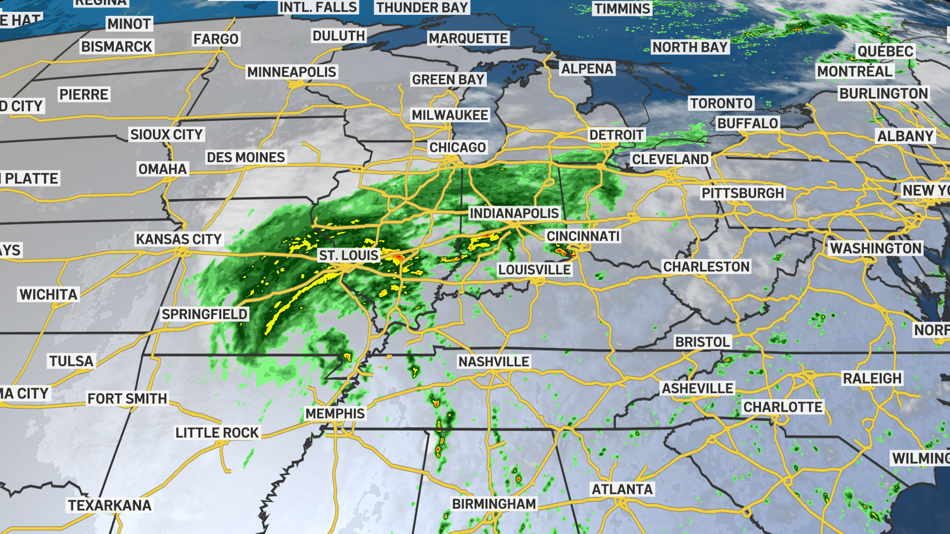
With no immediate rain chances on the horizon, the fire danger will be elevated to high this week. The combination of low humidity, dry conditions, and breezy weather could quickly spark grass-fires.
Click here to see all North Texas weather alerts
Get top local stories in DFW delivered to you every morning. Sign up for NBC DFW's News Headlines newsletter.
Latest Forecast:
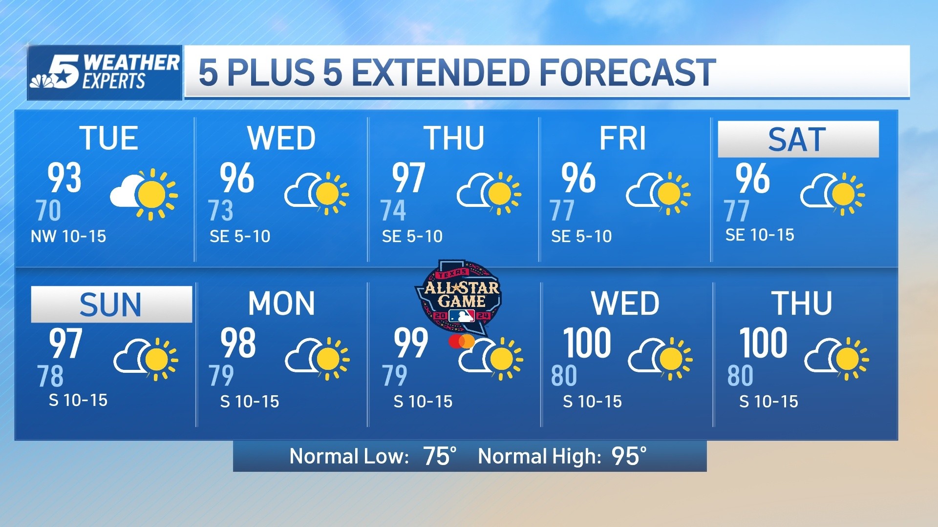
WEDNESDAY: Much cooler and breezy with a good deal of sunshine. High: 68. Wind: E 15-20 mph, decreasing in the afternoon.
TONIGHT: Mostly clear and chilly. Low: 46. Wind: E 5-10 mph.
THURSDAY: Chilly in the morning, then mostly sunny and pleasant. Low: 46. High: 72. Wind: SE 5-10 mph.
FRIDAY: Mostly sunny, breezy and mild. Low: 53. High: 78. Wind: SE 10-15 mph.
SATURDAY: Partly cloudy, breezy and mild. Low: 59. High: 80. Wind: SE 10-20 mph.
SUNDAY: Partly cloudy, breezy and mild. Low: 59. High: 80. Wind: SE 10-15 mph.
MONDAY: Partly cloudy and pleasant. Low: 59. High: 80. Wind: SE 10-15 mph.
TUESDAY: Partly cloudy and pleasant. Low: 62. High: 85. Wind: S 10-15 mph.
WEDNESDAY: Partly cloudy and warm. Low: 65. High: 87. Wind: S 10-15 mph.
THURSDAY: Partly cloudy and warm. Low: 65. High: 85. Wind: S 10-15 mph.
FRIDAY: Warm with a mix of clouds and sun. Low: 63. High: 84. Wind: S 10-15 mph.