Happy first day of Fall! Hot temperatures are sticking around for one final day before cooler weather returns to North Texas. Partly sunny skies are on deck today with highs climbing into the low 90s this afternoon.
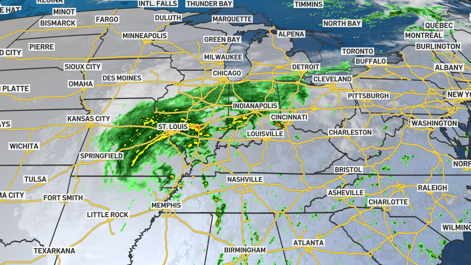
A cold front will arrive late Sunday into early Monday, bringing scattered showers and thunderstorms to the region.
Much of the rain will exit by Monday morning, however, a few spotty showers may linger into the afternoon. North winds will usher in more comfortable temperatures with highs returning to the 80s for the week ahead.
Click here to see all North Texas weather alerts
Get top local stories in DFW delivered to you every morning. Sign up for NBC DFW's News Headlines newsletter.
Latest Forecast:
SUNDAY: Partly sunny and hot. High: 93. Wind: S 5-10 mph.
TONIGHT: Clouds increase, showers and thunderstorms arrive. Low: 68. Wind: SSE 5-10 mph.
MONDAY: Variably cloudy and cooler with a 30% chance of showers and thunderstorms. High: 80. Wind: NNW 5-10 mph.
TUESDAY: Partly cloudy with a 20% chance of showers and thunderstorms. Low: 67. High: 85. Wind: NE 5-10 mph.
WEDNESDAY: Partly cloudy with a 20% chance of showers and thunderstorms. Low: 67. High: 85. Wind: NE 5-10 mph.
THURSDAY: Partly sunny and seasonable. Low: 66. High: 85. Wind: NE 5-10 mph.
FRIDAY: Partly sunny and seasonable. Low: 65. High: 85. Wind: NE 5-10 mph.
SATURDAY: Mostly sunny and warm. Low: 66. High: 87. Wind: NE 5-10 mph.
SUNDAY: Partly sunny and warm. Low: 67. High: 88. Wind: NNE 5-10 mph.
MONDAY: Mostly sunny and warm. Low: 67. High: 87. Wind: NE 5-10 mph.
TUESDAY: Mostly sunny and warm. Low: 67. High: 87. Wind: NE 5-10 mph.