
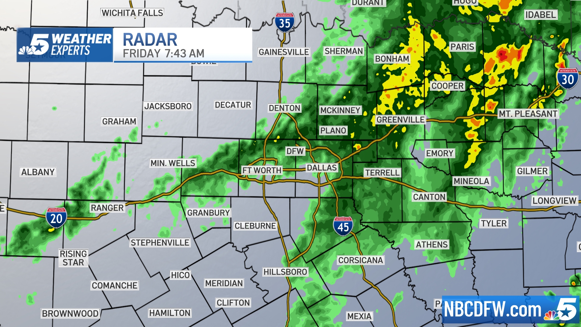
Widespread rain this Friday morning will stick around for several hours. Some of it could be heavy, especially from DFW to the east. Most of it will be tapering off by afternoon with cloudy skies. This evening should be dry.
The weekend forecast will begin with cloud cover and fog early Saturday. Then sunshine and 80s can be expected. There's a slight chance for brief thunderstorms late Saturday night, which could bring gusty winds if they develop. There's another chance of thunderstorms Sunday evening. While limited in coverage, these could be severe if they get going (especially east of DFW). Be sure to remain "weather aware."
Watch NBC 5 free wherever you are
A brief cool-down arrives Monday before temperatures rebound back into the by next Tuesday and Wednesday.
Get top local stories in DFW delivered to you every morning with NBC DFW's News Headlines newsletter.
WEATHER

Latest Forecast:
FRIDAY: Mostly cloudy with diminishing rain chances by the afternoon. High: 70. Wind: SE 10-20 mph with higher gusts.
TONIGHT: Mostly cloudy with fog developing late. Low: 64. Wind: SE 10 mph.
SATURDAY: Morning fog, then partly cloudy, breezy and warm. Slight chance of storms Saturday night. Low: 64. High: 84. Wind: S 10-20 mph with higher gusts.
SUNDAY: Partly cloudy and quite warm with a 30% chance of isolated thunderstorms toward late afternoon or evening. Low: 66. High: 88. Wind: W 10-20 mph.
MONDAY: Partly cloudy and cooler. Low: 51. High: 70. Wind: NE 10-15 mph.
TUESDAY (APRIL BEGINS): Partly sunny, breezy and warm. Low: 54. High: 80. Wind: SE 10-20 mph.
WEDNESDAY: Partly to mostly cloudy with a 20% chance of showers and thunderstorms. Low: 65. High: 85. Wind: S 10-15 mph.
THURSDAY: Partly cloudy and warm. Low: 61. High: 85. Wind: S 10-15 mph.
FRIDAY: Partly cloudy and warm. Low: 63. High: 87. Wind: SE 10-15 mph.
SATURDAY: Partly cloudy, breezy and warm with a 20% chance of showers and thunderstorms. Low: 62. High: 84. Wind: S 10-15 mph.
SUNDAY: Partly cloudy with a 20% chance of showers and thunderstorms. Low: 60. High: 78. Wind: E 10-15 mph.
Click here to see all North Texas weather alerts